
|
venuefinder |
A new tool for you to find distances to venues and also the way there! Simply click on the sample route map image below and, under 'Options' below the map, enter the postcode of where you live (in the 'Postcode 1' box) and the postcode of the venue you wish to drive to (in the 'Postcode 2' box). Click on 'Show' and it will give you a map showing the route, the distance 'As The Crow Flies' (the red line), and the distance by car (the blue line), both in miles. As with most online maps, you can enlarge the detail by repeatedly clicking when the black hand appears or using the sliding scale tool on the left. Incidentally, the route shown below is from Hale Drive, Mill Hill NW7 to Hatch End Playing Fields. Some other links you may find useful follow below: AA ROUTE FINDER GREEN FLAG ROUTE PLANNER TRANSPORT FOR LONDON JOURNEY PLANNER 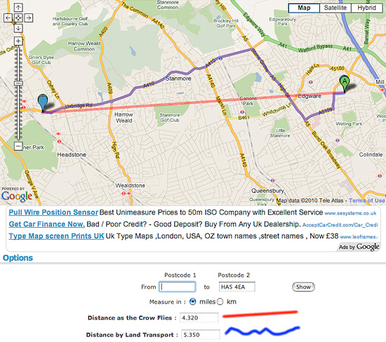 |
 |